What is WebODM?
WebODM is a free, user-friendly software to process drone imagery. Drones carry payloads (think cameras and other sensors) that collect data. The drone collects individual images or photographs using a camera (or sensor) payload. These sensor payloads store images as individual jpegs or tiffs on a memory card. While the individual images (often captured in jpeg or tiff images) can be helpful for Earth observation, these images, when mosaiced (or stitched) together through image processing techniques, create a single seamless image (or a map). The captured images contain latitude and longitude coordinates, and image distortion is minimized through the software. The final product, a seamless image mosaic, is also tied to latitude and longitude coordinates. This final product is often called an orthophoto (or orthomosaic).1
An orthophoto created with drone imagery is often a highly detailed (think small pixels) map of the Earth’s surface where distortions (associated with cameras and lenses, camera angle, topographic relief) are corrected. An orthophoto is a ‘smart map.’ This product supports a clear visual representation of the Earth’s surface that can be used to measure distances, areas, and volumes accurately. WebODM can be used to generate orthophotos from imagery captured by drones. In addition to orthophotos, WebODM can also create an array of other products, including point clouds, digital elevation models, contour maps, plant health indices, etc. This tutorial will initially explore the navigation of the user interface and the creation of orthophotos. It will focus on these other products later.
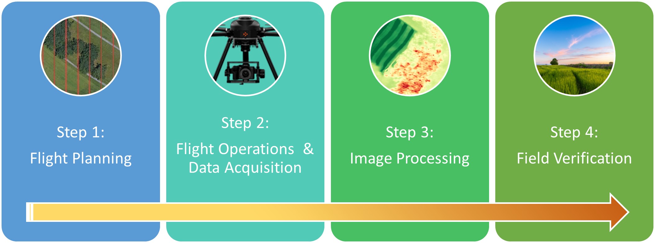
In summary, drones are merely vehicles that carry payloads. The payloads capture information and data about the Earth’s surface in the form of images. Software is required to process the captured data and to generate image mosaics and other products. But there are several steps associated with an sUAS workflow. Figure 1 illustrates a typical sUAS workflow. This manual assumes you are comfortable with the workflow’s first two steps (Flight Planning and Flight Operations) since this tutorial focuses solely on Step 3 (Image Processing). With that being said, if you are not comfortable with Step 1 and Step 2, access to sample image datasets is provided in the tutorial so that you can explore the processing and analysis options associated with WebODM without operating a drone. You can also reference other tutorials and resources (that will help you with Step 1 and Step 2) through the Virginia Geospatial Extension Program YouTube Channel (https://www.youtube.com/user/VaGeoExtension ) and through printed tutorials available through the VirginiaView Website (https://virginiaview.cnre.vt.edu/tutorials ).

There are many commercial software options that can generate an orthophoto. WebODM is one of these options. But WebODM has several advantages:
- It is (sort of) free (more on that later)!
- It runs on either Windows or IOS.
- It is user-friendly.
- It also has relatively low computer specification requirements (but there are advantages to having a faster computer).
- Since WebODM is open source, it is a collaborative effort. This software is being enhanced and updated on an ongoing basis. It is supported by a global community!
—
